3D Modeling & Digital Twins
High-precision mapping and topographical data. Our Matrice 4 Enterprise fleet, equipped with mechanical shutters and RTK integration, delivers centimeter-level accuracy for large-scale industrial photogrammetry.
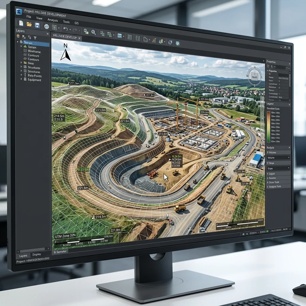
Volumetric Analysis
Precise stockpile measurement and quarry management data.
BIM Integration
Seamless data export to Revit, AutoCAD, and other industry standards.
As-Built Documentation
Digital recording of physical assets for maintenance and compliance.
Technical
Capability
We deploy industry-leading hardware and software suites to ensure that every mission meets our rigorous standards for safety and data precision.
Request Custom Solution